CEPAL (ECLAC). Port movements.

Data available for Latin-American and Caribbean Countries since 2000-2018

This statistical indicator is the result of the sum of the container movement (throughput) measured in TEU (Acronym for twenty-foot equivalent unit) of the ports and port areas of each country.

Visit website

UNCTAD Stat. Container port throughput, annual

Data available for all World Countries since 2010-2019

This table presents the total number of containers handled by a port, per country, expressed in twenty-foot equivalent units (TEUs). A TEU represents the volume of a standard 20 feet long intermodal container used for loading, unloading, repositioning and transshipment. A 40-foot intermodal container is counted as two TEUs.

Visit website

UNCTAD Stat. Liner shipping bilateral connectivity index, annual

Data available for all World Countries since 2006-2019

The table presents the liner shipping bilateral connectivity index (LSBCI), which indicates a country pair's integration level into global liner shipping networks. The LSBCI is an extension of UNCTAD’s country-level Liner Shipping Connectivity Index (LSCI) and based on a proper bilateralization transformation.

Visit website

UNCTAD Stat. Liner shipping connectivity index, annual

Data Available for all World Countries since 2006-2019.

The table presents the liner shipping connectivity index (LSCI), which indicates a country's integration level into global liner shipping networks. The LSCI is an index set at 100 for the maximum value of country connectivity in 2006, which was China.

Visit website

UNCTAD Stat. Merchant fleet by flag of registration and by type of ship, annual

Data available for all World Countries since 1980-2019

This table shows statistics on the international maritime transport. It contains data on the size of the world merchant fleet by flag of registration and by type of ship. Data are presented in thousands of dead-weight tons (DWT). The table presents also, for each region or country 1) its share in the world fleet, and 2) the share of a ship-type in its fleet. From 2011 onwards, the figures on numbers of ships are also available, as well as the data in gross tonnage (GT).

Visit website

UNCTAD Stat. Merchant fleet by country of beneficial ownership, annual

Data available for all World Countries since 2014-2019.

The table provides information on the ownership of the merchant fleet for all countries. "Ownership” refers to “Beneficial Ownership Location”: it indicates the economy in which the company that has the main commercial responsibility for the vessel is located. The economy of beneficial ownership may be different from the country in which the vessel is registered. Regarding “Flag of Registration” the table presents data for the 20 biggest registries for a given year. The registries with data presented thus vary from year to year. In addition, the total of these 20 registries, the total of other registries and the total for the world, are presented. Data refer to the beginning of a year indicated and are presented in thousands of deadweight tons (DWT) and in number of ships. DWT is a weight measure of a vessel's carrying capacity. It includes cargo, fuel and stores.

Visit website

UNCTAD Stat. Port liner shipping connectivity index, annual

Data available for all World Countries since 2006 – 2019.

The Port LSCI (PLSCI) reflects a ports' position in the global liner shipping network. A higher value is associated with better connectivity. The Port LSCI is set at 100 for the highest value in 2006. The port LSCI complements the country LSCI, using the same methodology, but applied on the port level. It was generated upon request of many users of the country LSCI who considered it useful to track the Liner Shipping Connectivity of individual ports.

Visit website

UNCTAD Stat. Port call and performance statistics: number of arrivals, time spent in ports, vessel age and size, annual

Data available for all World Countries for 2018

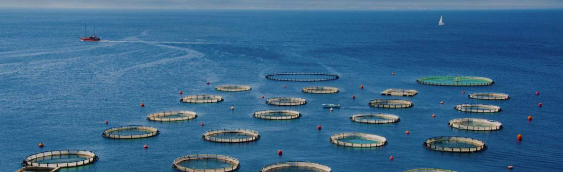
The Port calls and performance table provides an overview of the ships and the time they spent in the country’s ports during one calendar year. It includes statistics for up to 8 market segments, covering the number of port calls per year, the median time the ships spend in the ports, as well as information about the average age and size, and the size of the largest ships that have called during the year. The aggregated figures are derived from the fusion of automatic identification system (AIS) information with port mapping intelligence by MarineTraffic (http://marinetraffic.com), covering ships of 1000 GT.  Only arrivals have been considered to measure the total number of port calls. To produce any measurement, there must be at least 10 arrivals on a country level per commercial market made by at least 5 distinct vessels as segmented. Passenger ships and RO/RO ships are excluded from time at port calculations.

Visit website

UNCTAD Stat. Ship scrapping by country of demolition, annual

Data available for 45 Countries since 2014-2018.

This table shows estimates of the merchant fleet demolished between 1 January and 31 December of a given year.

Visit website

UNCTAD Stat. Ships built by country of building, annual

Data available for 57 countries since 2014-2018

This table shows estimates of the merchant fleet demolished between 1 January and 31 December of a given year.

Visit website

UNCTAD Stat. Merchandise trade matrix – product groups, exports in thousands of United States dollars, annual

Data available for all World Countries since 1995-2018

This table presents merchandise trade by trading partner and product based on the SITC commodity classification, Revision 3, at the one- and two-digit level, expressed in thousands of United States dollars. The data are also summarized by group of economies, for both reporting economy and trading partner, and by broader product groups.

Visit website

UNCTAD Stat. World seaborne trade by types of cargo and by group of economies, annual Data available for 20 group of countries since 1970 – 2019 (2006-2019 for some of them)

This table shows data on the world seaborne trade by types of cargo and by group of economies. Data are presented in millions of metric ton.

Visit website

UNCTAD Stat. Volume growth rates of merchandise exports and imports, quarterly

Data available for all World Countries since 2005-2019

This table presents quarterly statistics on world total merchandise export and import volume indices by individual economy, geographical region and economic grouping. The data presented are the result of the common work of World Trade Organization (WTO) and UNCTAD, and are published simultaneously by both organizations.

Visit website

WTO. Merchandise exports by product group and destination – annual (Million US dollar)

Dataset available for all World Regions 2013 - 2018

This table represents statistics of the world exports by origin and destination, classified by region and by sector of production. Data represent by million US dollars.

Visit website

UNCTAD Stat. Seafarer supply, quinquennial, 2015

Data available for all World Countries for 2015

This table provides estimated supply of seafarers that operates the world merchant fleet, including their nationalities and rank.
Officers: refers to deck officers, engineer officers, telecommunications personnel holding certificates of competency issued by competent authorities.
Ratings: refers to seafarers other than officers.
Estimations are done by the source and are based on one or more of the following:
- figures reported by the country in 2015
- figures reported by the country in 2010
- ships under the country’s flag
- industry experts.

Visit website